

“This deep warm water is expected to emerge at the surface in the coming months, which increases the likelihood of El Niño.”
The bureau said that most international forecast models also anticipate the conditions to emerge between late autumn and late winter before running into the second half of the year.
Some models have also suggested the potential for a strong or even super El Niño, however, that will not reflect the strength of its influence on Australian weather.
An El Niño system develops when warmer-than-average water lies at the top of the central and eastern tropical Pacific Ocean and cooler-than-average water sits at the top of western tropical Pacific waters.
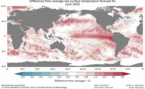
The water surface temperatures play a role in wind and pressure changes in the overlying atmosphere, which act to reduce cloud and rainfall in parts of the country.
The forecast comes as the Bureau of Meteorology declared that the La Niña season ended on March 31.
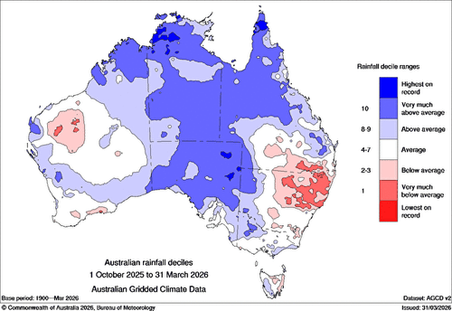
Despite bringing flooding in multiple states, the Bureau of Meteorology described the most recent La Niña episode as “relatively weak” due to the lack of wet weather it brought to some parts of the country.
“This is a good reminder that no two La Niña events are the same and their impacts can vary considerably from one La Niña to the next.”
NEVER MISS A STORY: Get your breaking news and exclusive stories first by following us across all platforms.

